
I’ve spent years zigzagging through cities by bus, and San Antonio sticks out in my memory. There’s a laid-back rhythm here that makes getting around feel pretty stress-free, whether you’re riding a VIA bus, wandering the River Walk, or renting a bike. San Antonio offers multiple transportation options including public buses, rideshares, bike shares, and walkable downtown areas, making it accessible for visitors without cars. You’ll see that downtown attractions pretty much link up on their own, while the VIA system spreads out to neighborhoods and sites all over the place.
Lots of visitors stress about not having a rental car, but honestly, San Antonio works out well for budget travelers and bus fans. The city’s more spread out than Boston or New York, but the main tourist stuff clusters downtown. And let’s be real—trying to park during Fiesta or a Spurs game? Transit’s just the better move.
Key Takeaways
- San Antonio’s VIA bus system links downtown attractions, missions, and neighborhoods citywide
- Downtown areas like the River Walk and Alamo Plaza are easy to walk, with bike and scooter rentals around
- With options from buses to rideshares, you can explore San Antonio without renting a car
Understanding San Antonio’s Transportation System

San Antonio covers about 500 square miles. VIA Metropolitan Transit handles most public transportation, and major highways like Loop 1604 wrap around the whole metro area.
Public Transit Overview
VIA Metropolitan Transit basically runs the show for public buses in San Antonio. There are over 90 bus routes that link downtown with neighborhoods, universities, and medical centers.
Regular buses will get you almost anywhere, but VIA Prímo is the one to try if you’re tired of getting stuck in traffic. It’s their bus rapid transit—dedicated lanes, level boarding, real-time arrival screens, and you’ll actually move faster than the cars on I-10. Feels like a small miracle some days.
Fares are simple. One ride is $1.30, or grab a day pass for unlimited rides. The VIA goMobile app lets you pay right from your phone, which is so much easier than digging for coins. Seniors, students, and folks with disabilities get reduced fares if they’ve got the right ID.
VIA also runs VIAtrans for door-to-door rides if you have a disability, and VIA Link for on-demand rides in areas regular buses don’t cover. It’s not Uber, but it fills in the blanks.
Major Highways and Roadways
Loop 1604 circles the metro like a giant belt. Use it to skip downtown traffic and get from one side of the city to the other.
Inside the loop, I-10 runs east-west, I-35 goes north-south, and I-37 heads southeast toward Corpus Christi. They all cut through downtown, so during rush hour (7-9 AM and 4-6 PM), things slow to a crawl.
US 281 runs up north and connects to the airport. If you’re headed to the Hill Country or the medical center, you’ll probably end up on it.
Key Transportation Apps
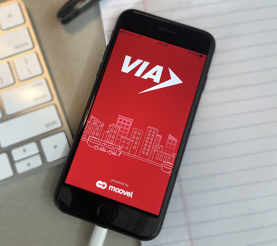
The VIA goMobile app is honestly a lifesaver for public transit. It shows real-time bus locations, lets you buy tickets, and plans your route. No more guessing if you missed the bus or if it’s just late.
Google Maps works well with VIA bus routes too. It pulls in the schedules and gives you walking directions to the nearest stop.
Uber and Lyft both run throughout San Antonio. They’re a solid backup when buses stop for the night (most end by 11 PM during the week) or if you’re going somewhere the bus doesn’t really reach.
VIA Metropolitan Transit: Buses and How to Use Them
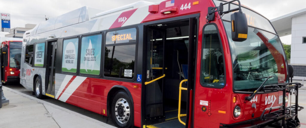
VIA Metropolitan Transit covers 90 routes across San Antonio and nearby areas, running every day from early morning to late night. The mobile apps help you plan trips, pay fares, and check schedules, and there are more than 6,000 stops all over Bexar County.
VIA Bus Routes and Services
VIA serves 1,210 square miles, including 14 cities and unincorporated parts of Bexar County. You’ll find 90 routes connecting neighborhoods, downtown, and all the big destinations.
The Prímo 100 is a favorite for getting downtown. It runs from 4:00 a.m. to 1:00 a.m. every day, so you’re covered for early mornings and late nights. Express routes also link downtown with spots all over San Antonio, making long trips a little less painful.
Downtown has the densest bus service, running from early to late. If you’re staying central, you’ll rarely wait long for a VIA bus.
VIA Link is a little different—it’s on-demand and operates in certain zones, good for neighborhoods that don’t have as many regular buses.
How to Use the VIA goMobile+ and VIA App
The VIA goMobile+ app is your main tool for figuring out the system. Download it to your phone for trip planning, live updates, and schedule info. It’s honestly the fastest way to figure out what bus you need and when it’s coming.
Google Maps shows VIA schedules if you’re already using it. Zoom in on San Antonio and look for the blue bus icons. Tap any icon to see the routes and next bus times.
The Transit App is another solid pick for trip planning and live departure times, so you’re not left guessing.
For quick updates, text the 5-digit number posted at any bus stop to 52020. You’ll get the next bus time for that stop—no more standing around wondering what’s up.
Bus Fare, Passes, and Discounts
VIA offers plenty of payment options. If you’re just riding once in a while, single fares are easy.
Day passes are great if you’re hopping on and off all day—they cost less than paying ride by ride. Multi-day and monthly passes give even better value if you’ll be in town for a while or riding a lot.
Seniors, students, and people with disabilities get discounted fares, but you’ll need to show ID to get those rates.
You can buy passes in the VIA goMobile+ app, so you don’t have to worry about cash or exact change. Some shops around San Antonio sell VIA passes too if you prefer buying in person.
Tips for Navigating Bus Stops and Schedules
Each VIA stop has a 5-digit number posted. Keep an eye out for it—you’ll need it for those text updates.
Bus schedules are on the VIA website, but honestly, the apps are better since they show real-time arrivals, not just planned times.
Check the VIA Service Alerts page before heading out. Detours and delays happen, and you don’t want to wait for a bus that’s been rerouted.
Try to get to your stop a few minutes early. Buses usually run on time, but traffic and other stuff can throw them off a bit—or sometimes they show up ahead of schedule.
If you need to transfer, ask your first driver for a transfer slip when you board. It’ll save you from paying twice for what’s basically one trip.
Getting Around Downtown San Antonio
Downtown is more walkable than you’d think, with the River Walk and Alamo Plaza right at the center. Still, it helps to know your parking options and which buses get you to places outside the core.
Exploring the River Walk and Alamo Plaza
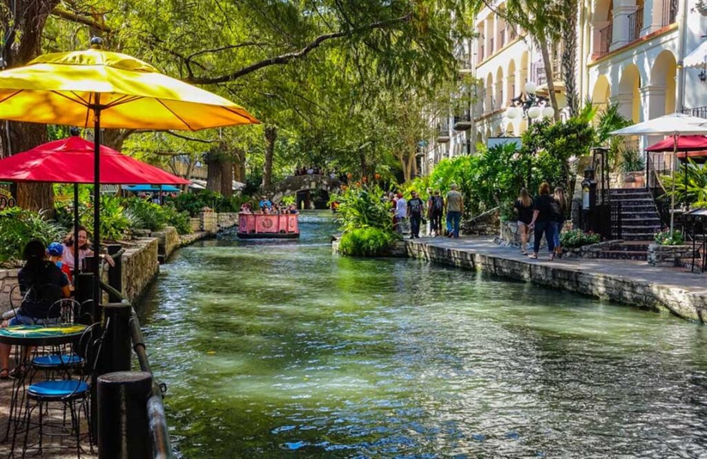
The River Walk snakes about 15 miles through San Antonio, but the downtown stretch is just 3 miles along the river. You can walk the whole thing in about an hour if you’re moving fast, though let’s be honest—most people stop to look around or grab a snack.
The path sits a level below the street, which gives it a vibe you really have to see for yourself. Stone staircases pop up regularly, so you can climb up to street level for the Alamo or lunch, then duck back down to the river.
Alamo Plaza is right in the thick of it, just steps from the River Walk. It’s compact and fully pedestrian-friendly. Bus stops line the streets around the plaza, making it a natural hub if you’re using VIA.
Here’s a tip I wish I’d known sooner: wear comfy shoes. Cobblestones and stairs look charming, but your feet will be tired after a few hours.
Walking Tours and Pedestrian-Friendly Areas
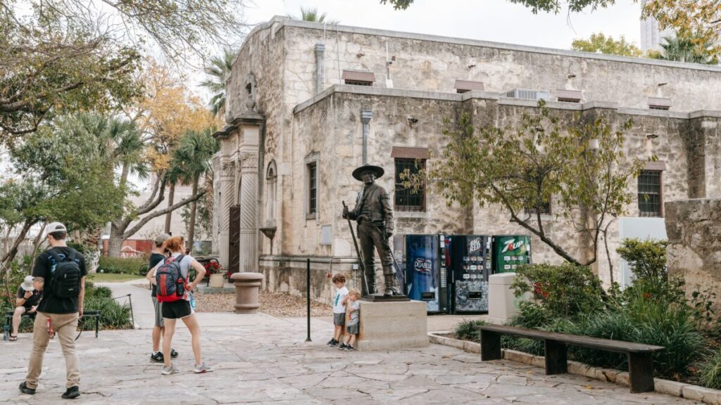
Downtown works really well for walking, especially from the Pearl district down the River Walk to Hemisfair Park—about 2.5 miles end to end.
The streets around Alamo Plaza, Market Square, and the River Walk have wide sidewalks and lots of crosswalks. But honestly, the further you get from these main spots, the less friendly it is for pedestrians.
VIA Link is available downtown for $1.30 a ride, running 7am to 11pm every day. Request a ride in their app or call ahead.
Downtown Parking Options
Parking downtown isn’t as bad as you might fear, but it does cost. Surface lots and garages charge $5 to $20 depending on how close you are to the action.
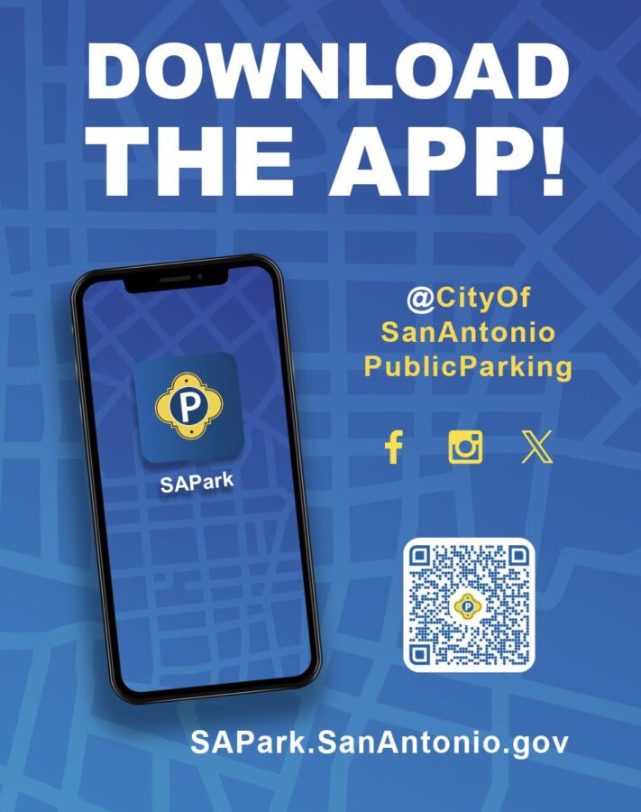
The SAPark app shows real-time parking availability in garages and lots. You can even pay through the app, so you’re not stuck feeding meters or searching for change. Street parking exists, but it’s gone fast—especially on weekends.
If you’re riding VIA into downtown, you can skip the parking headache. Bus stops circle the Alamo and River Walk, connecting you to neighborhoods and attractions all over San Antonio.
Navigating San Antonio by Car

San Antonio’s road network includes big highways like I-10 and I-35, with Loop 1604 wrapping the city’s outer edge. Downtown streets are narrow and mostly one-way, so it’s easy to get turned around if you’re new here.
Driving in the City
Driving here has its own rhythm, but you’ll pick it up. The main highways—I-10 (east-west) and I-35 (north-south)—connect most major areas. Rush hour hits hardest from 7-9 AM and 4-6 PM, especially by the Alamodome and AT&T Center.
Downtown’s a different beast. Narrow, one-way streets mean you might loop around a few times before finding your turn. Near the River Walk and Alamo Plaza, weekend traffic can get intense.
One thing you’ll notice: frontage roads run alongside most highways. They give you access to businesses and neighborhoods without jumping back on the main lanes. Takes a bit to get used to, but honestly, they’re handy once you do.
Heavy rain sometimes floods certain roads. If you see water rushing across, just turn around—it’s not worth it.
Parking and the SAPark App
Downtown parking costs anywhere from $5 to $15, depending on the area and whatever’s happening that day. Street meters let you park for free after 6 PM and all day Sunday—definitely a bonus if you’re out for dinner or catching weekend events.
The SAPark app makes parking a lot less annoying. You can check for open spots, pay from your phone, and even add time if you’re running late—no need to dash back to feed the meter. The app covers city-run lots and garages all over downtown.
Hotels usually tack on extra parking fees, sometimes $20-30 a night. Valet service pops up at most upscale restaurants and runs about $10-15 plus tip.
Near the Pearl District, you can grab free parking on weekdays before 2 PM. Southtown, on the other hand, has pretty limited street parking, especially when First Friday rolls around.
Loop 1604 and Major Roadways
Loop 1604 circles the edges of San Antonio and links up with the airport via US-281. It’s the main drag if you’re staying out in the suburbs or heading to spots outside downtown.
US-281 heads north from downtown and gets you to the airport in about 15-20 minutes if traffic isn’t a mess. I-10 connects San Antonio to Houston (roughly three hours east) and runs west toward El Paso.
The loop can clog up during rush hour, especially near Stone Oak and La Cantera. Construction seems to always be happening somewhere, so checking traffic before you leave is just smart.
If you’re headed to the Mission Trail or Six Flags Fiesta Texas, you’ll probably end up using these main roads.
Airport, Arrivals, and Transfers
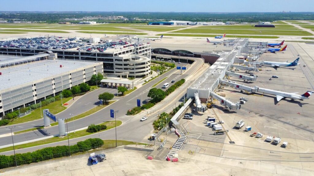
San Antonio International Airport sits about 8 miles north of downtown. You’ve got a few ways to reach the city center: a cheap VIA bus for $1.30, plus taxis and rideshares if you want to get there faster.
San Antonio International Airport Access
San Antonio International Airport has two terminals—A and B—linked on the landside, so getting between them is a breeze. All ground transportation lines up on the Lower Roadway at the Arrivals/Baggage Level.
After you grab your bags, just head outside and cross the marked crosswalk. Buses, taxis, and rideshares all wait at the outer curb.
The airport serves both domestic and international flights, though most are domestic. You’ll spot plenty of “Ground Transportation” signs in the arrivals area, so you won’t be left wandering around.
Public Transit and Shuttle Connections
VIA Metropolitan Transit runs bus service from the airport straight to downtown. The VIA bus stop sits at the far west end of Terminal B and is easy to find.
Route 5 is the main line into the city, running daily and getting you downtown in about half an hour for $1.30. If you’re watching your budget, it’s tough to beat. Bus frequency changes throughout the day and on weekends, so check the schedule before you go.
Coming from Stone Oak? Route 7 Express runs Monday through Friday, 5:45 a.m. to 7:00 p.m., every 30 minutes. It’s a quick 15-20 minutes non-stop, and the fare is $2.60.
VIA’s $2.75 Day Pass covers unlimited rides. You can buy it on the bus, online, or through VIA’s goMobile app. Transfers between buses don’t cost extra, which is always handy.
Taxis and Rideshare from the Airport
Taxis wait at stands on the lower level outside both terminals. They’re metered, and the ride to downtown usually takes 15-20 minutes, traffic willing.
Uber and Lyft pick up from marked zones on the Arrivals Level. Just follow the signs or check your app for the exact spot. These areas can get crowded during busy times, so plan for a short wait.
You can grab a ride right when you land or schedule one ahead of time. Rideshares usually cost less than taxis for the same trip, but prices jump when demand spikes.
Biking, Scooters, and Alternative Mobility

San Antonio’s been growing its bike lanes and scooter options lately, making two-wheeled travel a real choice for short hops or just cruising around. Bike-share stations dot downtown, electric scooters are scattered everywhere, and trails connect neighborhoods to parks.
Bike Share Programs and Trails
The city’s bike-share system makes it easy to grab a n) for exploring downtown or nearby spots. Pick up a bike at one station and drop it at another—super convenient if you’re bouncing between attractions or want to skip the bus for a few miles.
The Howard Peak Greenway Trail network offers paved paths away from cars. These trails connect neighborhoods, business districts, and parks, so you can ride without dodging traffic.
Downtown has the most bike-share stations, clustered near the big sights, restaurants, and hotels. Download the app before you ride—it shows where bikes are available and lets you unlock them with your phone.
San Antonio launched a Bike Network Plan in 2023 to add protected lanes and safer crossings. For now, stick to marked trails and bike-friendly streets if you’re not comfortable mixing with traffic.
E-Scooters and Micro-Mobility Options

Lime and Bird scooters are all over downtown. You’ll see them on sidewalks near busy spots, and they’re a cheap way to cover a mile or two without ordering a car.
Just download the app, scan the QR code, and you’re rolling. Most charge a small unlock fee plus a per-minute rate.
Scooters save you from parking headaches and traffic jams—huge when you’re in a rush. Plus, they’re just fun to ride, especially when it’s too hot to walk blocks and blocks.
Keep an eye out for rough sidewalks and pedestrians. The city has rules about where you can ride and park, so check your app for any restricted zones.
Exploring Brackenridge Park and Urban Green Spaces
Brackenridge Park sits just north of downtown with 343 acres to explore by bike or scooter. Trails connect the park to the rest of the city, so you can get there without too much street riding.
Inside, paved paths wind past the San Antonio Zoo, the Japanese Tea Garden, and the Witte Museum. It’s a great spot for a relaxed ride when you want some greenery but don’t want to leave the city behind.
Trails along the San Antonio River are also nice for biking. You can follow the water through different neighborhoods and get a feel for the city’s layout. These riverside paths stay pretty flat—not much of a workout, just an easy way to get around.
Connecting to San Antonio’s Top Attractions
San Antonio’s top sights—from Spanish colonial missions to riverside monuments—are scattered across the city, but you can get to most of them by bus, rideshare, or just walking, depending on where you start.
Getting to the Alamo and Historic Sites

The Alamo sits right in the middle of downtown, so it’s super easy to reach. If you’re near the River Walk, you can walk there in under 10 minutes. Admission is free, but you’ll need a timed ticket during busy seasons.
VIA buses stop at Alamo Plaza, and several routes drop you within a block or two. The VIVA lines are especially useful—they hit all the major tourist areas. The stop’s right on Houston Street, just steps from the entrance.
Coming from farther away? Rideshares drop off on Alamo Street near the back. Street parking fills up fast, especially on weekends, so get there early or use a paid garage on Commerce Street—it’s usually about $10 for the day.
Market Square and La Villita, two other historic spots, are both walkable from the Alamo. La Villita sits right across from the River Walk, and Market Square is maybe a 15-minute walk west. Buses run along Commerce and Dolorosa if you don’t feel like walking.
Visiting the San Antonio Missions
The four southern missions—Concepción, San José, San Juan, and Espada—make up a national historical park along the Mission Trail. San José is the biggest and gets the most visitors; they call it the “Queen of the Missions.”
VIA’s Route 42 goes to Mission San José and then on to the other missions, but buses can be pretty spaced out. Check the schedule first, since you might wait an hour between buses. The goMobile+ app helps you track arrivals in real time.
Biking the Mission Trail is honestly one of the best ways to see it. The paved path is about 8 miles long and connects all four sites with clear signs. San Antonio BCycle has stations downtown, but you’ll need your own bike or a rental for this trip since the bike-share doesn’t reach that far south.
Driving gives you the most flexibility—there’s free parking at each mission, and you can go at your own pace. From downtown, Mission Concepción is closest, about 15 minutes away. Rideshares work too, but you’ll need to call a new one for each stop, which adds up.
Traveling to Parks and Cultural Destinations

Brackenridge Park covers 343 acres on the city’s north side and includes the San Antonio Zoo, Japanese Tea Garden, and Witte Museum. VIA buses (Routes 7 and 8) stop near the zoo and main park entrances.
The Pearl District, a favorite for food and weekend markets, sits just north of downtown. You can walk from the River Walk in about 20 minutes, or hop on Route 1 or 8. If you’re driving, the Pearl garage offers free parking before 2 PM on weekdays.
For Hemisfair and Southtown, walking’s usually easiest. Hemisfair is right by the convention center, and Southtown’s art and food line South Alamo Street. Bird and Lime scooters are scattered around if you’d rather not walk.
The DoSeum and McNay Art Museum are farther north. You’ll probably want a car or rideshare for those, since bus routes are limited and the trip can drag past 45 minutes.
Frequently Asked Questions
VIA Metropolitan Transit runs San Antonio’s bus system, with options from regular to express routes. You can also get around with rideshare apps, taxis, and bike rentals.
What are the best modes of public transportation for navigating central San Antonio?
VIA buses are the main public transit option for getting around central San Antonio. The network covers downtown and links major spots like the River Walk, the Alamo, and Market Square.
VIA Prímo, the bus rapid transit, runs along busy routes in dedicated lanes. It’s faster than regular buses since it skips most of the traffic. These buses have real-time arrival info, so you know exactly when yours is coming.
Most downtown attractions are within walking distance, but when you’re tired, hopping on a VIA bus saves you the trouble of finding parking.
Buses stick to set schedules, and you can check arrival times with the VIA goMobile app. That way, you’re not wasting time waiting at stops.
Where can I find the San Antonio public transportation map for bus routes?
The VIA goMobile app is honestly the easiest way to check bus routes. Just download it on your phone and you’ll see all the stops, schedules, and lines right there. Super handy if you’re out and about and need quick info.
If you’re more of a paper map person, VIA transit centers keep physical maps on hand. You’ll spot these centers at busy spots around San Antonio, so they’re not too hard to find.
You can also pull up the VIA website to look at or print any route map before you leave home. Each map shows stops, times, and how to connect with other lines—makes planning transfers a lot less confusing.
Most bus stops have posted info about the routes and nearby landmarks, but honestly, the app just makes life easier. It’ll even show where you are and which stops are closest.
Is there a river shuttle service available in San Antonio, and how do I find the route map?
San Antonio does have river shuttle services along the River Walk, but they’re not part of VIA’s public transit. These river taxis and shuttles are more of a tourist thing than a regular way to get around.
You’ll find info about the river shuttles right on the River Walk or at downtown tourism offices. Most nearby hotels also keep maps and schedules at the front desk.
The water taxis stop at different points along the river, connecting you to restaurants, shops, and hotels. Honestly, it’s more about the experience than getting somewhere fast.
Fares for the river shuttles are separate from VIA buses, so your bus pass won’t work here. Think of it as a fun extra if you’re visiting, not your main way to get around.
How can I obtain a bus pass for traveling around San Antonio?
The VIA goMobile app lets you buy passes right on your phone. You can grab a single ride, a day pass, or something longer if you’re sticking around for a while.
Day passes cover unlimited rides for 24 hours, which is great if you’re hopping on and off all day. It usually saves you money over buying tickets one by one.
You can also pick up passes at VIA transit centers with cash or card. Some local shops sell them, but honestly, the app is just faster.
If you’re 65 or older, have a disability, or qualify for reduced fares, you’ll need a VIA Reduced Fare ID Card. You’ll have to bring some paperwork to a transit center, but it’s worth it for the savings.
And if you’d rather just pay on the bus, that works too—just bring exact change since drivers don’t carry any.
What are the alternatives for getting around San Antonio if I don’t have a car?
Uber and Lyft both operate all over San Antonio, including airport pickups. They’re pretty handy if you want to skip waiting for a bus and just get where you’re going.
Traditional taxis still cruise around San Antonio, especially downtown and by hotels. You can flag one down or just call for a pickup if you prefer.
San Antonio’s pretty bike-friendly, and you can rent bikes to explore the city at your own speed. Most days, the weather’s pleasant enough for cycling, though the summer heat can be a bit much sometimes.
Walking works great in downtown, where most attractions sit close together. The River Walk is especially nice for pedestrians—lots of shade and scenery to enjoy along the way.
VIA Link runs an on-demand rideshare service in certain areas where regular buses don’t go. It’s kind of a mix between a bus and a rideshare app, and it usually costs less than Uber, but you might need to plan a little more than you would for a standard bus ride.
If you have mobility challenges, VIAtrans can help with door-to-door service if you qualify. You’ll need to apply ahead of time, but it really opens up the city when regular buses aren’t an option.


