
I’ve spent years navigating cities by bus, and Cleveland surprised me in ways I didn’t expect. Cleveland offers a bunch of ways to get around, including an extensive public bus system, light rail, rideshare services, and bike-friendly routes that connect neighborhoods and major attractions all over the city. The transit network here works better than you’d probably guess for a mid-sized Midwestern city.
You don’t really need a car to get around Cleveland, though it does make some spots easier to reach. The RTA (Greater Cleveland Regional Transit Authority) runs buses and trains that cover downtown, University Circle, and outlying neighborhoods. Once you get the hang of the main routes, the system feels pretty straightforward.
Whether you’re just here for a weekend or settling in for a longer visit, knowing your transit options helps you zip between Cleveland’s museums, sports venues, and lakefront spots. The city keeps adding bike lanes and making key districts more walkable, so it’s honestly more accessible now than it was a few years back.
Key Takeaways
- Cleveland’s RTA system gives you bus and rail service connecting downtown, the airport, and major neighborhoods
- Downtown and spots like Ohio City are walkable and have growing bike infrastructure
- Plenty of ways to get around—public transit, rideshares, car rentals, or biking depending on your plans
Public Transportation Options
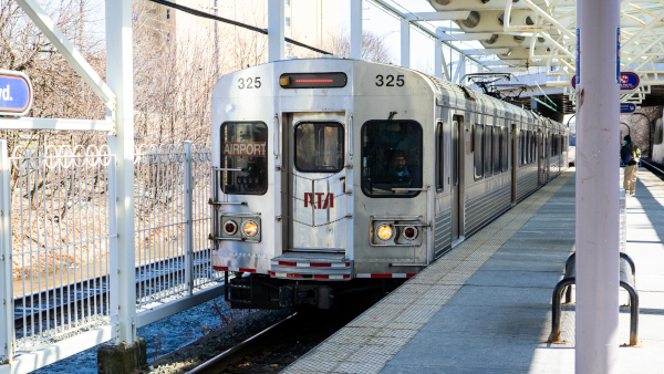
The Greater Cleveland Regional Transit Authority runs the city’s public transit network with four rail lines and a big bus system that reaches most neighborhoods. You’ll also find rapid transit services like the HealthLine, which gets you around faster than old-school buses.
Regional Transit Authority Rail Lines Overview
The RTA operates four separate rail lines connecting downtown Cleveland to surrounding areas. The Red Line runs from Cleveland Hopkins International Airport to Tower City, then east to several neighborhoods. If you’re flying in and want to skip pricey rideshares, this is your best bet.
The Blue and Green Lines head east from Tower City toward Shaker Heights. These lines have a weird payment system—you pay when you get off if you’re heading west into downtown, but pay when you board if you’re going east. It feels a little confusing at first, but you’ll get used to it.
All the rail lines meet at Tower City Center downtown, which acts as the main hub. Trains run from early morning to late evening on weekdays, with shorter hours on weekends.
Greater Cleveland Bus System Details
RTA runs a bunch of bus routes throughout Cleveland and nearby communities. Most buses connect to downtown or bigger transit centers where you can switch to other lines or hop on a train.
Bring exact change if you’re paying cash—drivers won’t make change, and that catches a lot of first-timers. It’s way easier to grab a farecard from a ticket machine if you can. The 5-trip farecards give you 2.5-hour transfer privileges, so you can switch buses without paying again.
Bus stops have round target symbols, sometimes with route numbers. Try to show up at least five minutes early; buses tend to stick to their schedules. You can track buses in real time with Google Transit or RTA’s trip planner tools.
Rapid Transit and the HealthLine
The HealthLine is Cleveland’s bus rapid transit running along Euclid Avenue from downtown through University Circle. It’s faster than regular buses because it has its own lanes and fewer stops. Pay at the station before you board—hang on to your proof of payment until you get off.
This line connects big spots like the Cleveland Clinic, Case Western Reserve University, and museums in University Circle. Buses show up every 5-10 minutes during rush hour.
Transit police do check fares sometimes, so don’t risk it—just pay before you ride.
Cleveland State Line and BRT Services

The Cleveland State Line is another key bus route that serves Cleveland State University and nearby neighborhoods. It links students and locals to downtown and other major transit points all day long.
Besides the HealthLine, Cleveland’s bus rapid transit focuses on busy corridors with better stations and more reliable schedules than standard buses. These services try to mix the flexibility of buses with the speed and reliability people usually expect from rail.
RTA keeps expanding these faster bus routes to areas without rail. If you’re planning a trip, call the Community Connection Line at 216-621-9500 during business hours—real people pick up and help you figure out the best routes.
Navigating Downtown Cleveland

Downtown Cleveland’s grid layout makes it easy to find your way, whether you’re coming by bus or just wandering on foot. The compact core packs major attractions within walking distance, and you’ve got plenty of ways to get between the key spots.
Essential Downtown Routes
Downtown’s main streets run on a simple grid. Superior Avenue and Euclid Avenue are the big east-west roads, cutting right through the heart of the city. Ontario Street and East 9th Street handle most north-south traffic.
If you’re arriving by bus, you’ll probably end up at the transit center on Superior Avenue. From there, you can walk to most downtown attractions in 10-15 minutes. The waterfront is up north, and Progressive Field plus the theater district are a few blocks east.
The numbered streets make navigation a breeze. The higher the number, the farther east you are. That’s about it.
Key Destinations and Landmarks
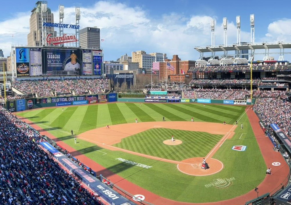
Progressive Field anchors the Gateway District on the east side of downtown. It’s at Carnegie and Ontario, and you can’t miss it during baseball season.
The Rock and Roll Hall of Fame sits right on the lakefront at North Coast Harbor. It’s about a 20-minute walk from the main bus terminal, but totally worth the stroll. Playhouse Square, one of the country’s biggest theater districts outside New York, runs along Euclid Avenue between East 14th and East 17th streets.
Public Square is dead center downtown where Superior and Ontario cross. It’s a handy spot to get your bearings. Tower City Center links up underground to the RTA rail system if you need to go further than walking distance.
Trolley Services in the City Center

The HealthLine bus rapid transit runs down Euclid Avenue and feels almost like a trolley, with its own lanes and frequent service. It connects downtown to University Circle, stopping at major spots every few blocks.
Traditional trolley-style services show up for special events and sometimes in the summer, but honestly, they’re not the most reliable for daily travel. Stick with the HealthLine or regular RTA buses for consistent service.
Some neighborhoods run free trolley loops in the summer, but schedules change every year. Ask around when you get to town to see what’s running.
Getting to and from Cleveland Hopkins International Airport
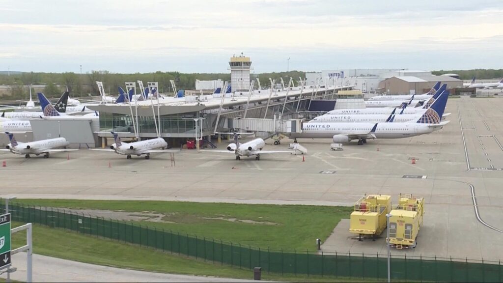
Cleveland Hopkins International Airport is about 12 miles southwest of downtown, and you’ve got a few solid ways to make the trip. The RTA Red Line train is the cheapest and probably easiest route, while taxis, rideshares, and rentals give you more flexibility depending on where you’re headed and when.
Public Transit Connections from the Airport
The RTA Red Line is honestly one of the better airport train links you’ll find in a city this size. The station sits right on the lower level of the main terminal—just take the elevators or escalators from ticketing or baggage claim and head down.
Trains leave every 15 minutes most of the day and get you to downtown’s Tower City Station in under 30 minutes. That’s often faster than driving during rush hour, and you won’t get stuck in I-71 traffic.
The fare is easy on your wallet, so if you’re traveling light and staying downtown, it’s a no-brainer. If you’ve got a ton of luggage or you’re heading somewhere the Red Line doesn’t reach, you’ll need to transfer or look at other options.
You can call the Regional Transit Authority at (216) 566-5100 for up-to-date schedules and fares. The system is simple enough that even first-timers can figure it out pretty quickly.
Airport Taxi and Rideshare Services
Taxis wait outside the main terminal on the arrivals level, and they’re there pretty much whenever flights land. The ride downtown usually takes 20-30 minutes, depending on traffic, and costs less than at big-city airports but more than the train.
Uber and Lyft pickups happen at designated spots—just follow the airport signs because they have specific zones for rideshares. Prices change with demand, so check your app before you land for a ballpark figure.
If you’re staying outside downtown or traveling with a group, both options work well. Split between three or four people, a rideshare can actually be as cheap as transit and drops you right at your hotel.
Rental Car Facilities and Shuttle Options
All the big rental car companies operate at Hopkins, with counters in the baggage claim area. Some park cars on-site; others run quick shuttle buses to nearby lots.
The airport sits just off I-71, so getting into Cleveland or out to other Ohio cities is pretty straightforward. No confusing exits or toll roads like you’d see on the East Coast.
Shuttle services and shared vans run from the airport to hotels and destinations around Greater Cleveland. If you’ve got airport parking booked for a longer trip or your hotel offers a pickup, it’s always worth asking when you make your reservation.
Walking and Biking in Cleveland
Cleveland scores 75 for walking and 55 for biking, which makes it a decent place to get around on foot or by bike. The city recently launched Cleveland Moves, a three-year plan to expand bike infrastructure and make streets safer for everyone.
Pedestrian-Friendly Neighborhoods

Downtown is your best bet for walking. Streets are laid out for pedestrians, and most attractions are close together.
Ohio City and Tremont are two neighborhoods that really pop for walking. Both have compact business districts where you can grab coffee, browse shops, and grab dinner without ever needing a bus. The tree-lined residential streets are fun to wander.
University Circle is another walkable area. Museums, gardens, and cultural spots cluster together here. You could spend a whole day bouncing between the Cleveland Museum of Art, the botanical garden, and Severance Hall without needing wheels.
Bike Share and Cycling Infrastructure

Cleveland has bike share programs that make renting a bike simple. Stations are scattered through downtown and popular neighborhoods. Just grab a bike, ride to your spot, and drop it at another station—easy.
The city has 246 cycling routes mapped by the community. The Cleveland Lakefront Bikeway gives you lake views on paved paths. If you’re into adventure, try Rocky River Reservation or the Ohio and Erie Canal Towpath.
Protected bike lanes are coming soon. The Cleveland Moves plan aims to quickly expand the bike network with better designs. You can pick up a Biking in Cleveland Guide at local bike shops or Bike Cleveland events to find the best routes.
Best Areas for Walking Tours

The lakefront is perfect for a walking tour. Edgewater Park has beach access and trails with water views. It’s flat and easy for any fitness level.
Downtown’s architecture makes for a fun self-guided walk. You’ll pass historic buildings, public squares, and the revamped waterfront. The Warehouse District has old industrial buildings now filled with restaurants and galleries.
The cultural gardens in Rockefeller Park show off different ethnic communities with landscaped gardens. It’s a unique walking experience, and the path links several gardens in a row.
Driving, Parking, and Car Rentals
Cleveland’s street grid is refreshingly simple compared to the maze of older East Coast cities. Whether you’re downtown or wandering the neighborhoods, there’s usually a decent shot at finding parking. Renting a car gives you the flexibility to get out of town without being tied to bus schedules, which is honestly a relief if you like to make your own plans.
Major Highways and City Navigation

Interstate 90 slices east-west through Cleveland, making it easy to reach downtown and the lakefront. I-71 heads southwest toward the airport and down to Columbus. I-77 runs north-south right through the city’s center.
The highways form a straightforward grid. Route 2 (the Shoreway) hugs Lake Erie and gives you some surprisingly nice views between downtown and the western suburbs.
Downtown streets follow a numbered grid, which honestly makes getting around much less stressful. Most big attractions are packed into a fairly tight area, so you’re unlikely to spend ages circling lost. Rush hour traffic can slow you down—think 7-9 AM and 4-6 PM on weekdays—but honestly, it’s nothing like Chicago or New York.
If you’re coming in winter, be ready for lake-effect snow and slick roads. It’s just part of the deal from November to March.
Parking Garages and Metered Areas

Downtown Cleveland has a bunch of parking garages and lots scattered around. Apps like ParkMobile let you check prices and snag a spot before you even pull in.
Metered parking lines a lot of downtown streets, but finding an open spot depends on the time of day. Expect to pay $1-3 per hour, and meters take cards or coins, which is nice when you’re short on change.
Garages usually run $8-15 for all-day parking downtown. Some offer early-bird specials if you show up before 9 AM. If there’s a game or show, expect prices to jump near the stadiums and theaters.
Honestly, it’s worth checking parking apps ahead, especially if you’re coming during busy times or for an event.
Tips for Renting and Using Cars

Cleveland Hopkins International Airport has all the usual rental car brands—Enterprise, Hertz, Budget, National. Their counters sit in baggage claim, and some providers use shuttle buses to off-site lots.
If you arrive by bus and decide you want a car for a day trip, you’ll find rental spots downtown too. Having a car opens up places like Cuyahoga Valley National Park (about half an hour south) or the Amish country out in the counties.
Booking online ahead of time nearly always gets you a better deal than just walking up. Most companies want you to be 25, but you can rent younger if you’re willing to pay extra fees.
Remember to fill the tank before bringing the car back—otherwise you’ll get hit with their high gas prices. Fortunately, gas stations are easy to find around town.
Moving to Cleveland: Long-Term Transportation Tips

If you’re settling in for the long-term, figuring out your daily transportation is a big deal for your wallet and your sanity. The Greater Cleveland Regional Transit Authority is the backbone of public transit, but whether you drive, bus, or mix things up depends a lot on where you end up living and working.
Commuting Strategies for New Residents
The Greater Cleveland Regional Transit Authority (RTA) runs the city’s bus and rail network, and honestly, it’s more reliable than a lot of folks expect. Buses run all over, but the HealthLine stands out—it’s a rapid bus line on Euclid Avenue that gets you from downtown to University Circle in about half an hour.
Monthly passes are about $95, which definitely beats paying for gas and parking if you’re heading downtown every day. The rail system has three lines—Red, Blue, and Green—that link up places like Hopkins Airport, downtown, and the east side suburbs.
Rush hour on I-90 and I-71 can get rough, especially in winter. If you drive, leave earlier than you’d like. And if your job lets you, try shifting your hours by even 30 minutes—it really helps.
Accessibility of Suburban Areas

If you move to the suburbs, odds are you’ll want a car. RTA buses reach places like Lakewood, Shaker Heights, and Cleveland Heights pretty well, but spots like Westlake, Strongsville, or Mentor don’t have much service.
If you’re hoping to live car-free in the suburbs, stick to the inner-ring spots along transit lines. Lakewood and Shaker Heights have the best bus frequency outside downtown. Go further out and you might see a bus once an hour—if at all on weekends.
Rideshares can fill the gaps, but daily use adds up fast. Some folks drive to RTA stations and hop the train in, which works if your job’s near a rail stop.
Choosing the Best Mode for Daily Life
Your best transit mix depends on you—there’s no magic answer. Downtown workers without kids often skip cars altogether and rely on RTA plus the occasional rideshare.
Think about:
- Weather tolerance – Waiting for a bus in a Cleveland winter is no joke
- Schedule flexibility – Evening and weekend bus service drops off
- Family needs – Grocery runs and kid stuff usually need a car
- Parking costs – Downtown spots run $10-20 a day
Plenty of locals end up with a hybrid routine: keep a car, but take the bus downtown to skip the parking pain. The HealthLine and trains are honestly pretty convenient on certain routes, even if the whole system isn’t perfect. If you’re into biking, Cleveland’s added protected lanes downtown, though winter riding isn’t for everyone (and I can’t really blame you).
Alternative and Private Transportation Options
Cleveland’s got more ways to get around than just public transit—rideshare apps, private shuttles, you name it. These come in handy for early mornings or late nights when the buses just aren’t running.
Rideshare Apps and Taxi Companies
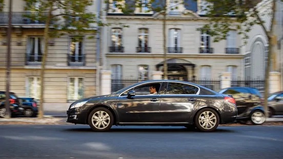
Uber and Lyft are all over Cleveland, and they’re usually the fastest way to get across town. Same drill as everywhere else—open the app, request a ride, and you’re off.
Traditional taxi companies are still around too. They’re reliable for airport trips and come in handy if your phone’s dead or you don’t have the apps. Calling ahead for a pickup actually works better than waiting and hoping, especially during busy times.
Heads up: rideshare cars can get scarce in the outer neighborhoods or during those weird early-morning hours (think 3 AM). If you know you’ll need a ride at an odd time, booking a taxi ahead might save you from being stranded.
Scooter Rentals
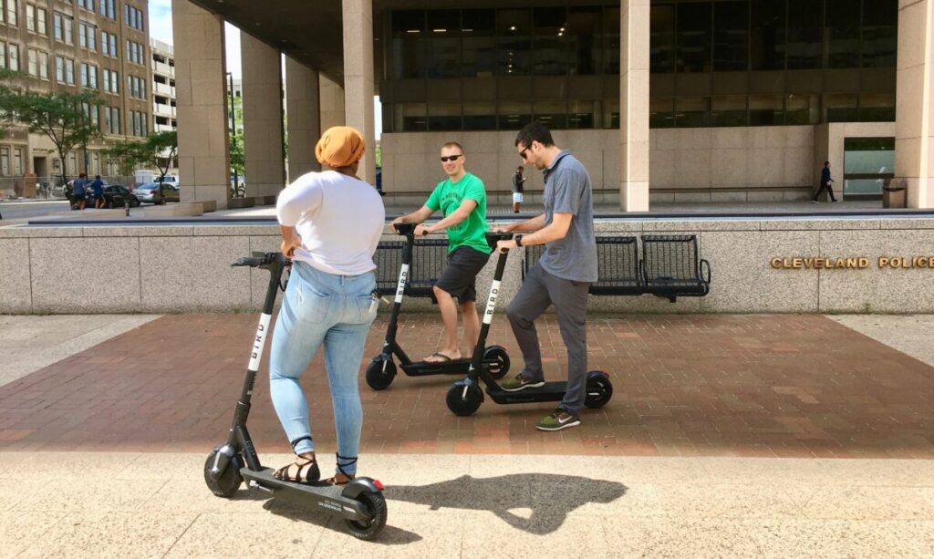
Electric scooters have popped up in Cleveland, but they’re seasonal. You’ll spot them downtown and in places like Ohio City during the warmer months.
Just unlock them with an app and pay by the minute—they’re great for short hops, like from your hotel to a nearby restaurant. For longer rides or if you’re lugging stuff, they’re not really ideal.
Once winter hits, the scooters disappear. From late fall to early spring, don’t count on finding one.
Shuttle and Limousine Services

Hotel shuttles pick up from the Ground Transportation Center at Cleveland Hopkins Airport, outside Door 1 by baggage claim. A lot of hotels offer free shuttle service, so check before you pay for something else.
If you’re traveling with a group or want a guaranteed ride at a set time, private shuttle and limo companies are an option. You’ll need to book in advance, and they’re pricier than rideshares, but they’re solid for airport transfers or special events.
Frequently Asked Questions
Cleveland’s transit system leaves newcomers and visitors with plenty of questions—how does the RTA really work, and do you actually need a car to get around?
What are the best public transportation options in Cleveland?
The RTA (Greater Cleveland Regional Transit Authority) runs the show when it comes to public transit. You’ve got buses, rail lines, and the HealthLine BRT system.
The rail system includes the Red, Blue, and Green lines. The Red Line links the airport to downtown and Tower City, which is super convenient if you’re flying in. The HealthLine is actually one of the better bus rapid transit lines out there—it runs between Downtown and University Circle along Euclid Avenue.
Regular RTA buses reach most neighborhoods. Service is frequent in the busier areas, but it thins out in the farther neighborhoods.
Can I rely on the RTA for daily commuting in
It really depends on where you live and work. If you’re commuting between downtown, Ohio City, University Circle, or along the rail lines, you’ll probably be just fine.
The HealthLine is especially reliable for daily commutes. It runs every 8-10 minutes during rush hour and connects major job centers. I know plenty of people who gave up their cars after realizing they lived near a HealthLine stop.
If you’re heading to the suburbs or working odd hours, though, it gets tougher. Evening and weekend service drops off, and some neighborhoods just don’t have much coverage.
What’s the most efficient way to use the Cleveland trolley system?
Cleveland doesn’t have the classic trolley system like San Francisco or New Orleans. When people say “trolley,” they usually mean the historic-looking buses on certain routes.
The HealthLine vehicles are modern and use dedicated lanes, so it’s a smoother, faster ride than a typical bus. You board at platform stations and pay before you get on.
For the easiest experience, grab the RTA app to check arrival times. HealthLine stations have real-time displays, but planning ahead never hurts.
How accessible are ride-sharing services like Uber in Cleveland?
Uber and Lyft work well in Cleveland, especially downtown and in busy neighborhoods. You won’t wait long in University Circle, Tremont, Ohio City, or downtown.
Usually, you’ll get picked up in 5-10 minutes or less during normal hours. Airport pickups are simple at Hopkins, with marked rideshare zones.
Rates are reasonable compared to big cities—you’re not paying New York prices here. Late nights on weekends, you might wait a bit longer if you’re out in the suburbs.
What tips do locals have for navigating Cleveland without a car?
If you want to go car-free, pick your neighborhood carefully. Ohio City, Tremont, Downtown, and University Circle are the most walkable with solid transit access.
Get a reloadable RTA pass if you’re riding a lot. The all-day pass is a good deal for multiple trips. And honestly, a bike can fill in the gaps where transit doesn’t quite reach.
Winter will test your car-free resolve. Some bus stops aren’t well-cleared after snow, and waiting outside in freezing weather is rough. Dress warm and maybe keep a backup rideshare fund for the worst days.
Download a few apps—RTA’s, Uber, and scooter apps like Lime or Bird. It’s good to have options when one system lets you down.
How user-friendly is the RTA Cleveland app for trip planning?
The RTA app covers the basics pretty well. You can plan trips, check real-time arrival info, and buy passes right from your phone.
The interface isn’t flashy, but honestly, it works. Real-time tracking seems more reliable on rail lines and the HealthLine than on regular bus routes. Sometimes the GPS for buses lags or just gives you the wrong info, which can be annoying if you’re in a hurry.
Trip planning feels simple—you type in where you’re starting and where you want to go, and it spits out route options with estimated times. You can also save your favorite stops and routes, which makes the daily grind a bit easier.
The app does crash or slow down sometimes, and the mobile ticket thing? Super handy when it works, but it can get glitchy right when you’re about to show your pass.


